Historical interview: the following preserves the research experiences and personal views expressed in the original manuscript.
Continuing from last time: beyond military uses, drones have already made their mark in many civilian fields.
Let us hear more!
Research and development of civilian drones
Research directions at development companies
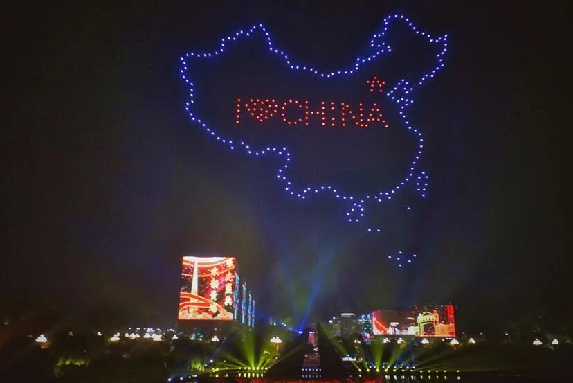
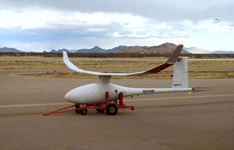
The focus of drone development is closely related to the type of drone. Fixed-wing types tend to have more military applications, although that is not absolute. Civilian consumer drones mainly involve rotary-wing development because they are beginner-friendly and easier to popularize. Their relatively simple functions can meet civilian needs such as photography, parcel transport, and light shows.
DJI drones’ selling points
My personal impression is that DJI does not develop drones as such, but primarily uses them as platforms for video and photography. It mainly develops camera stabilization; its aircraft development remains within the scope of consumer drones. It does not pursue particularly advanced drones, but uses them for filming.
Editorial check: this is the contributor’s personal impression. DJI’s published development record includes flight-control, gimbal, and imaging systems, so it cannot be summarized as “not developing drones.”
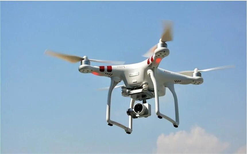
The hardware itself is not very expensive. You could assemble a drone of similar stability yourself for perhaps around ten thousand yuan in hardware; what costs more is the software and sensors.
For example, a normal photography drone transmits images to your phone or computer. But the images can also be processed within the drone to track a subject in real time and film while circling you through 360 degrees. It identifies you by recognizing your face or body shape. More demanding requirements, such as recognizing people as a class of targets, need additional development and therefore cost more.
Which civilian fields use drones?
[Making a living: agriculture]
Agricultural drones mainly perform crop-protection tasks such as sowing, pesticide application, and fertilization. In 2015, China had 2.025 billion mu of cultivated land but only a little over 2,500 crop-protection drones. Their overall coverage was therefore very low, below 0.6% of national cultivated land.
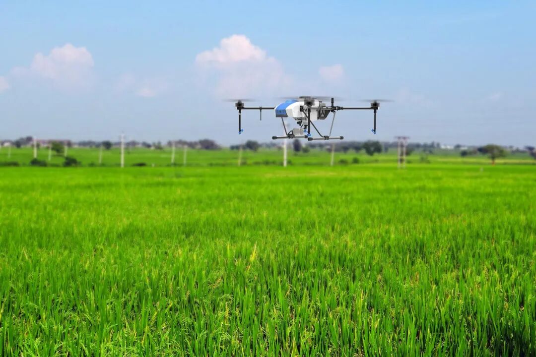
Farmers in developed countries in Europe and North America and parts of Japan had already begun using stable, mature drones for sowing. In China, crop protection still mainly relied on manual labor, with low levels of mechanization and intelligent technology.
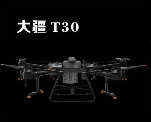
At present, competition in crop-protection drone development mainly involves DJI and XAG. Besides improving aircraft performance, such as wings, batteries, and payload, both also focus on flight training, sales, and after-sales service. Competition across these areas has increased nationwide use. In 2020, DJI released the T30 and T10 agricultural drones. The larger T30 primarily targets large fields in northern China, while the smaller T10 is designed for smaller plots in the south. Together, they aim to cover cultivated land across both regions.
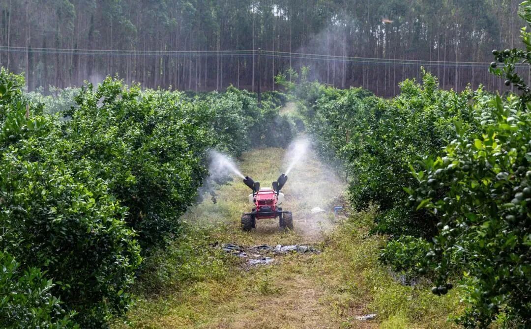
On December 15, XAG also introduced the more versatile R150 agricultural unmanned ground vehicle and professional agricultural drones including the P40, P80, and V40 at its annual event. These systems use AI prescription maps to generate appropriate pesticide application plans quickly from existing field information, a very practical and valuable function for farmers.
China is promoting agricultural integration, hoping to consolidate farmland into larger areas that can be managed, sown, and sprayed together. Renting drones and managing agricultural machinery are similar, much like harvesting services. This is mainly being promoted by agricultural machinery organizations.
Statistics indicate that by the end of 2019, China had more than 55,000 crop-protection drones, ranking first worldwide in equipment numbers. Yet their coverage still did not exceed 5% of cultivated land. China’s agricultural drone sector is therefore growing rapidly with a large market ahead.
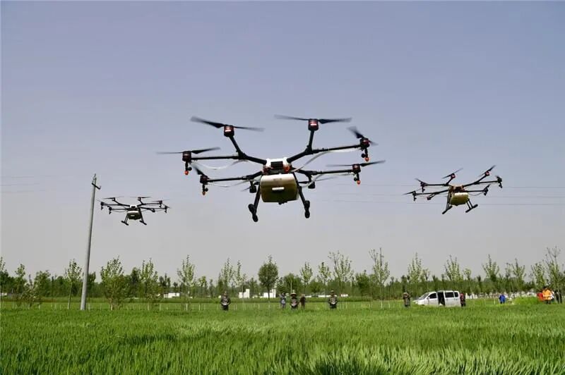
How were DJI’s two agricultural drones designed?
Their software is general-purpose and flight control is the same, but size and payload differ. Small fields do not need a large payload or long operating time, so the smaller capacity is more flexible and easier to control. Larger fields require drones with stronger payload capacity, reducing the number of flights and making them more convenient for farmers.
What about flight height and charging?
China has rules on flight height for crop-protection drones: generally only one or two hundred meters, not higher, because greater heights may affect civil aviation routes.
Editorial check: flight height depends on aircraft type, airspace, and current rules. The interview’s “one or two hundred meters” is not general permission to fly. See the official current management rules below.
Drone batteries can also support only about thirty minutes of flight, mainly for rotary-wing types. Direct fuel-powered agricultural drones can stay aloft for one to three hours, allowing pesticide application and field-information collection over larger areas.
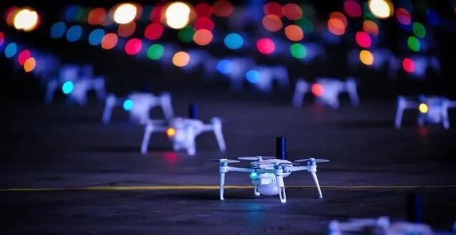
[Drone light shows]
Display drones have very simple structures designed for low cost. Apart from a GPS receiver for positioning, they mainly have a lighting-control system. They do not seek communication between drones, instead using centralized control of the fleet.
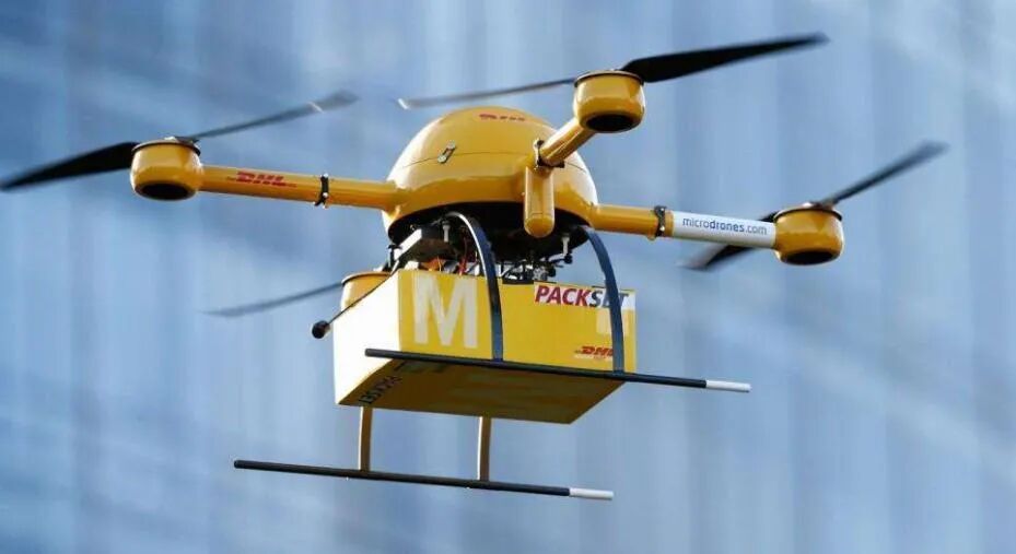
[Parcel delivery]
Manufacturers are exploring drone parcel delivery, but complex cities and insufficient rural infrastructure mean it remains a concept rather than a practical application at this stage. The pandemic gave drone goods transport a push because it allows contactless delivery; many such transfers took place during the pandemic.
Drone development
Why is it still at an early stage?
One reason is that relevant laws and regulations are not yet fully developed or implemented. Drones resemble unmanned or self-driving vehicles, which face the same issue.
Responsibility is difficult to establish if an accident occurs. Infrastructure is also incomplete, making positioning information unavailable across all airspace. GPS signals may fail in tunnels, indoors, or between tall buildings. Fault-tolerant control, safe landing, and return functions still need improvement. At this stage, it therefore remains a concept without the possibility of widespread adoption.
What technical challenges remain?
Drones are products of modern industry, and innovation in any industrial sector can improve their performance.
Challenge one: control of a single drone in unobstructed outdoor flight without interference is relatively mature, but existing control systems struggle with unexpected demands in complex battlefield environments. An online task-decision and fault-tolerance mechanism using AI or deep learning with relatively low computational demands is needed. This is an urgent problem for mission-equipment management and emergency control.
For example, civilian GPS accuracy is five to ten meters, so a drone may deviate from its planned route by that distance. But this assumes a GPS signal. If signals become temporarily unavailable or a drone is damaged on a battlefield, the formation needs fault tolerance. Suppose three drones are attacking two targets and one becomes unable to perform its task after damage. Tasks must then be redistributed so that the remaining two each attack one target. This illustrates task decisions and fault tolerance in a drone swarm.
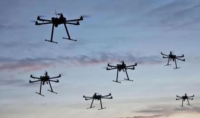
For an individual drone, fault tolerance can involve losing one of four components. If one wing is damaged, the remaining three might still allow flight, autonomous return, or landing to prevent damage to the aircraft. That is another kind of fault-tolerance mechanism.
Challenge two: drone flight still depends on satellite positioning, such as GPS, BeiDou, or Galileo. Satellite navigation does not yet provide sufficiently good parameters in all circumstances; when its signals are lost, drones must rely on inertial navigation. Its weakness is accumulating error, creating a challenge for navigation in complex environments. Future drones may need multiple navigation methods with high precision, reliability, and resistance to interference.
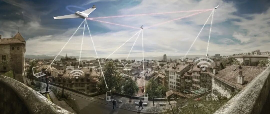
Challenge three: consumer drone batteries are relatively large and heavy, while energy-conversion efficiency, flight speed, and propulsion remain limited. This reduces endurance and cannot meet demanding requirements such as penetrating battlefield defenses. Civilian drones, including DJI photography drones and display drones, use lithium-polymer batteries with a basic cell voltage of 3.7 volts, usually in packs of three or four cells. Larger agricultural drones may need six cells of model-aircraft batteries and have endurance of around half an hour. Greater endurance requires larger batteries and therefore more weight. This affects both payload capacity and overall efficiency, creating a trade-off. Battery configurations must suit the intended needs.
Editorial check: battery specifications and endurance depend on the model and load. The official T30 battery specification gives a nominal voltage of 51.8 V; the original cell counts and half-hour endurance must not be applied to all large agricultural drones.
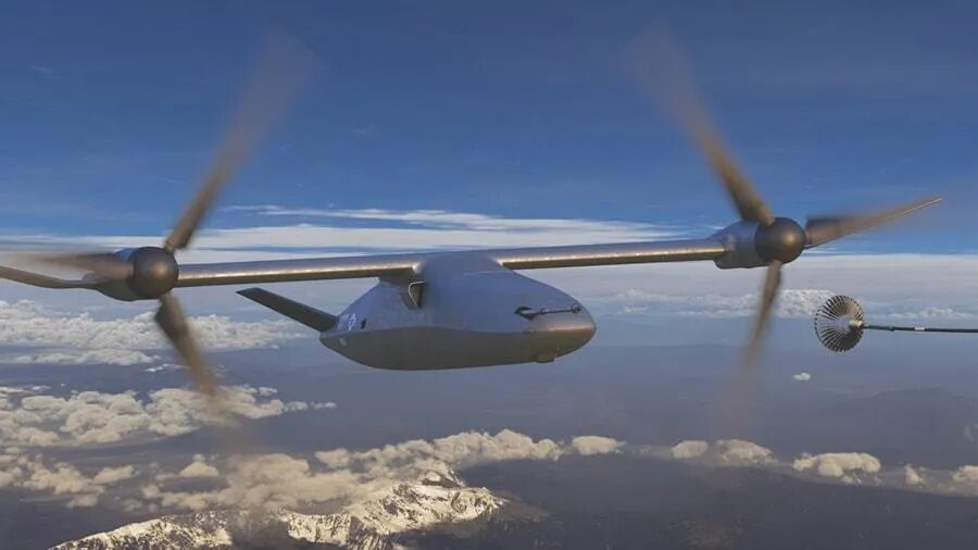
Developing new energy sources could therefore trigger a revolution in drone technology. We hope for a new energy supply, a structure better suited to endurance, or an improved propulsion system. Tiltrotor drones, currently a research focus, are a promising future direction.
Challenge four is data-link transmission. Because drones have no person controlling them onboard in real time, they depend heavily on data links for exchanging and transmitting information during remote control, telemetry, positioning, and tracking. Links also support data sharing, friend-or-foe identification, and task scheduling.
Ordinary drones mostly use custom line-of-sight data links, while medium- or high-altitude, long-endurance types usually use beyond-line-of-sight satellite links. With the development of 5G, onboard sensors will demand increasingly precise positioning and more complex tasks. A secure, reliable, high-bandwidth communication method is therefore important. In environments with lower all-weather requirements, laser communication may also appear as a future research direction. Put simply, a laser supplies light, information is placed on an optical modulator, and an optical transmitter sends it. At the receiving end, an antenna receives the laser signal and passes it to a photodetector; conversion to an electrical signal, modulation, and amplification then recover the original signal.
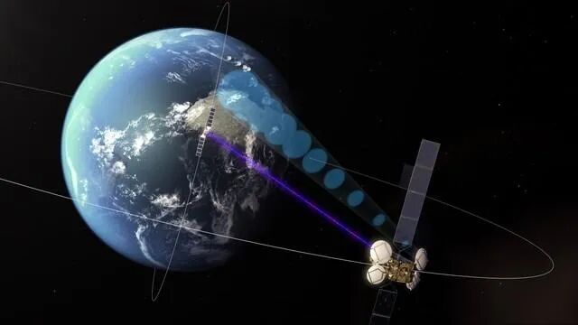
The problem with laser communication is its sensitivity to weather. Fog or dust can cause high losses because airborne particles scatter or absorb the light. I think laser communication currently remains limited to nearby points. In future it may work well for flight in outer space, geosynchronous satellites, and other environments with a very thin atmosphere and little pollution.
Science contributor: Boiled Egg with Chili Sauce
Text editors: Fantuan, Calorie
Audio editor: Honey Peach Oolong
Interview: Fantuan, Calorie
Audio recording: Honey Peach Oolong
*This article expresses the author’s personal views and does not represent those of this website.
Additional sources checked
Official Chinese regulation: Interim regulations on unmanned aircraft flight management
Sources and editorial history
Restored from a complete historical article exported from the PhDSciNet Official Account.
Editorial revision: The historical interview and personal views are retained, with separate editorial checks on DJI development, flight height, and battery specifications. Market figures and predictions about the “future” belong to the original context and are not presented as current market or investment conclusions.